File:Georgia 1817 State Map 24x27.jpg
Jump to navigation
Jump to search


Size of this preview: 515 × 600 pixels. Other resolutions: 206 × 240 pixels | 1,614 × 1,879 pixels.
Original file (1,614 × 1,879 pixels, file size: 882 KB, MIME type: image/jpeg)
Notes
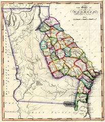
Notes - From: Samuel Lewis Atlas, 1817.
Citing this Source
Source Listing
Citation:Georgia 1817 State Map 24x27.jpg/Source Listing
Citation Listing
Gridley, Enoch G, and Samuel Lewis. The state of Georgia. [S.l., 1817] Map. Retrieved from the Library of Congress, <www.loc.gov/item/2004629000/>.
Link to Citation
- Citation:Georgia 1817 State Map 24x27.jpg/Source Listing
- Citation:Georgia 1817 State Map 24x27.jpg/Citation Listing
Wiki Codes
Source Listing:
{{Citation:Georgia 1817 State Map 24x27.jpg/Source Listing}}
Citation Listing:
{{Citation:Georgia 1817 State Map 24x27.jpg/Citation Listing}}
File history
Click on a date/time to view the file as it appeared at that time.
| Date/Time | Thumbnail | Dimensions | User | Comment | |
|---|---|---|---|---|---|
| current | 07:55, 10 April 2013 | | 1,614 × 1,879 (882 KB) | Wikiadmin (talk | contribs) | MsUpload |
You cannot overwrite this file.
File usage
There are no pages that use this file.